
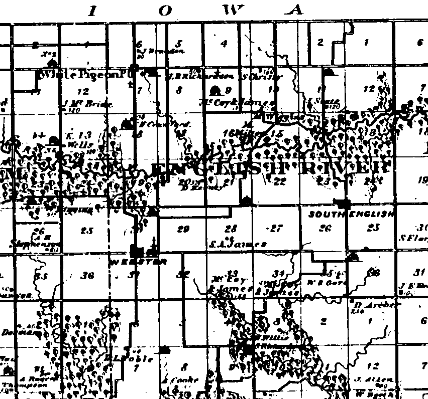
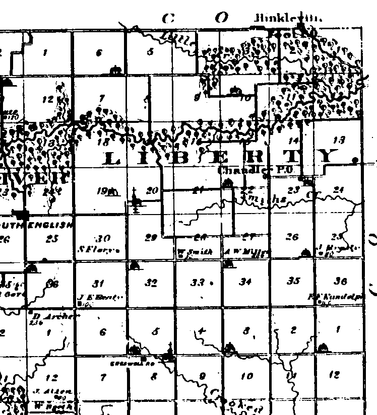
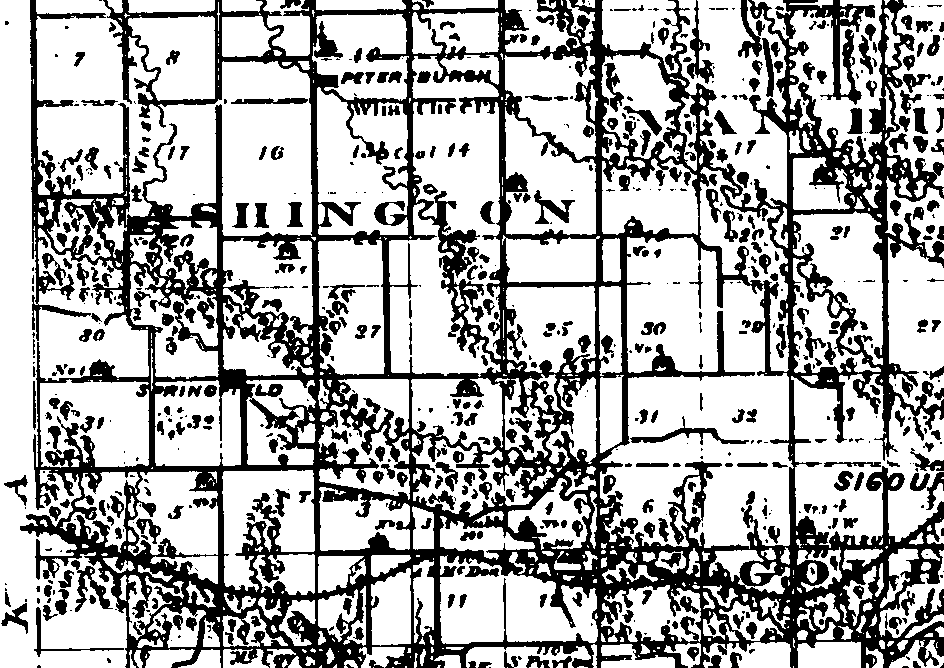
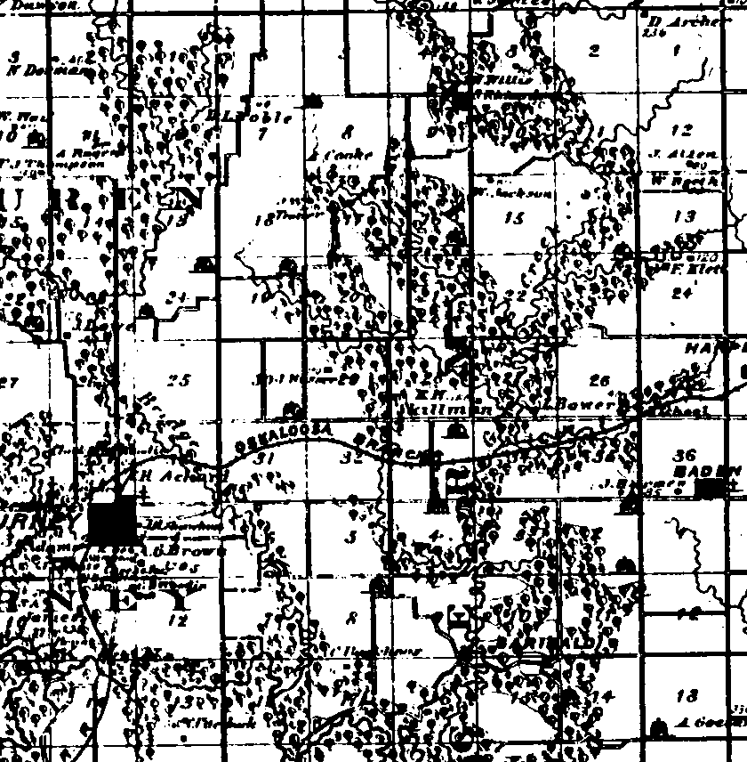
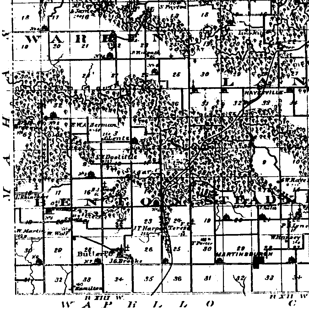
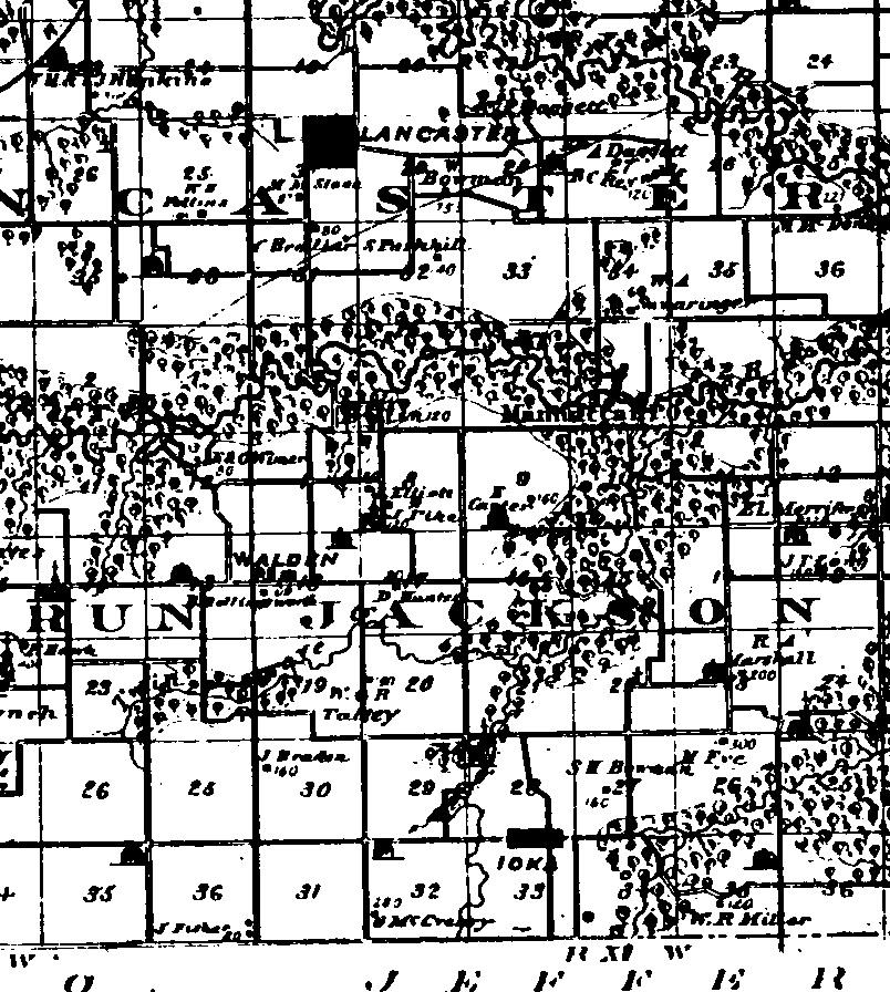
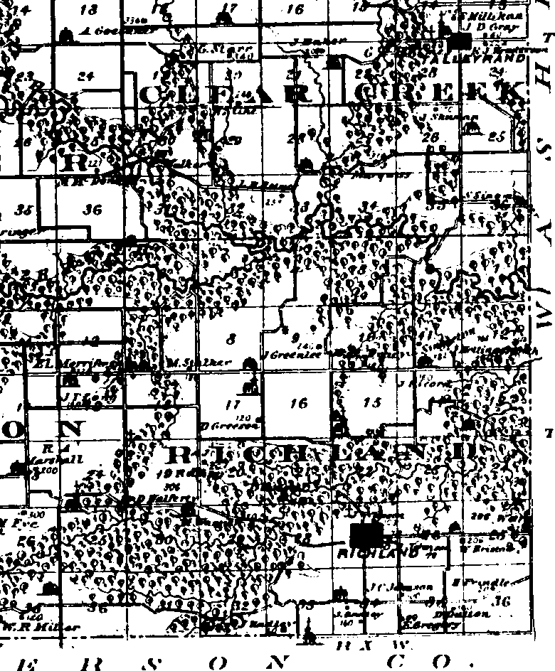
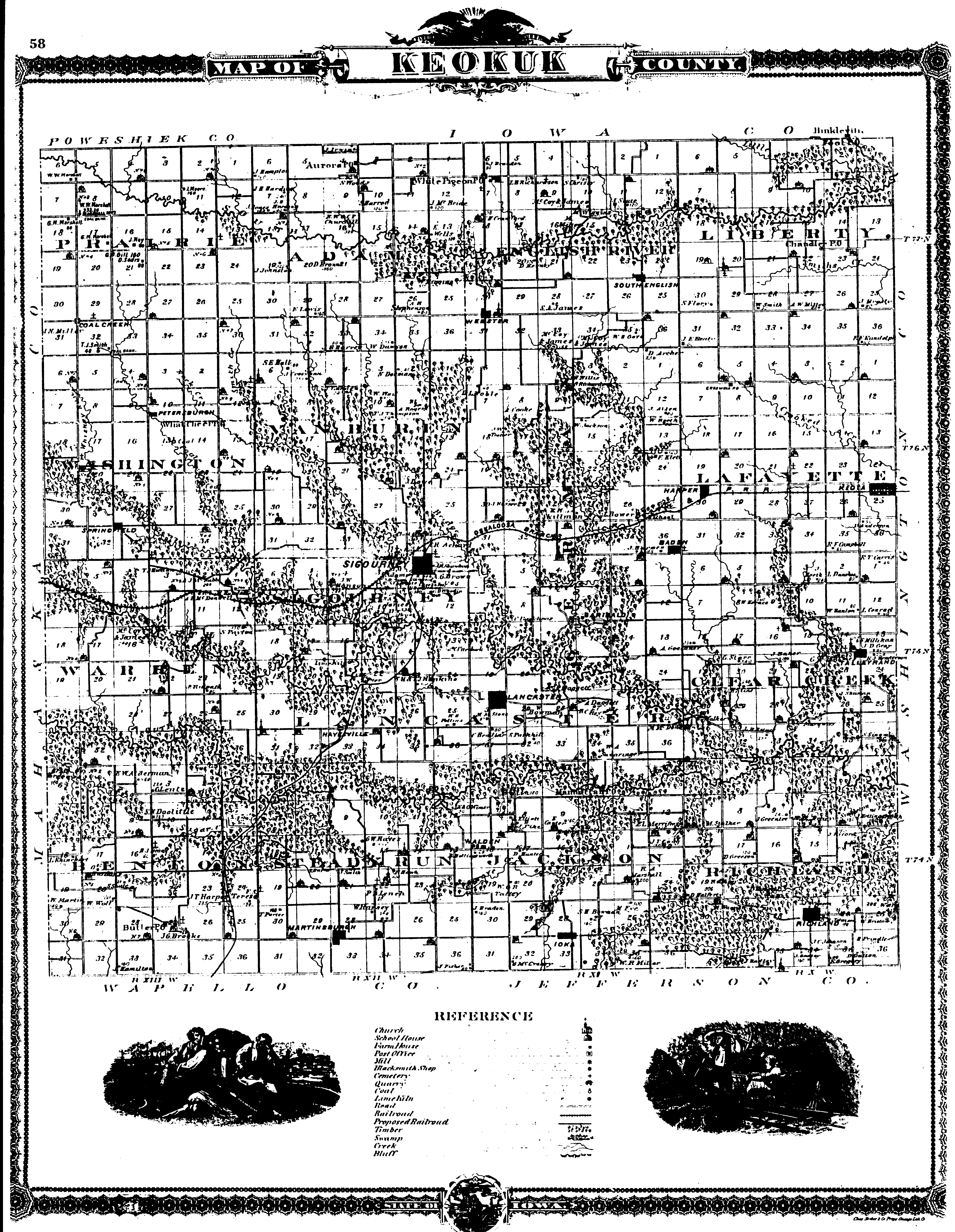
Keokuk County, Iowa 1875 Map
source was A. T. Andreas' Illustrated Historical Atlas of the State of Iowa. 1875
I divided the county map into 9 pieces as follows with north at the top:
piece3 piece6 piece9
piece2 piece5 piece8
piece1 piece4 piece7
Key to 1875 Map

Note: Large images may not always display properly with a web browser. You may find it useful to save as a file and
use a graphics program to display.
Entire 1875 Map of Keokuk - 837K IN SIZE, (It takes my connection
almost five minutes to download)
Return to
Keokuk County, Iowa Genealogy
Iowa Genealogy
Home Page